
I’ve collected the ‘Top 10 high-altitude treks in India’ which excites the adventure lovers the most. So, if you are an adventure buff, there is nothing as exciting, and fascinating as trekking for you. And when it comes to conquering high-altitude trekking, the ultimate fun doubles up. These high-altitude treks allow experiencing charming sceneries.
Although there are many hilly ranges in the world where you can trek, but the Indian Himalayan Region is the most liked by trekkers. These sky-touching snow-capped glaciated peaks are not easy to conquer, because some of them are even 5,960m in height. That’s why you must be mentally and physically prepared to do these high-altitude trekking.
So without further ado, let’s dive into the ‘Top 10 high-altitude treks in India’. You can learn to make a travel blog in 2021 by clicking here.
- Explore The Prehistoric Cave Paintings From Hundred Thousand Years Ago In Faridabad

- Top 10 Weekend Getaways From Delhi
- Top 10 Places To Visit On A Budget In India

- Top 10 Destinations To Visit In Winter In India
- Top 10 High-Altitude Treks In India
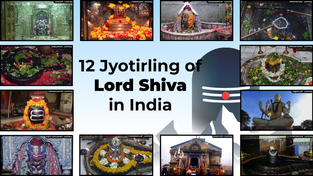
- The 12 Jyotirling Temples Of Lord Shiva In India

List of Top 10 High Altitude Treks In India:
- Chadar Trek, Jammu & Kashmir
- Stok Kangri Trek, Jammu & Kashmir
- Kinnaur Kailash Circuit Trek, Himachal Pradesh
- Darcha Padum Trek, Jammu & Kashmir
- Auden’s Col Trek, Uttarakhand
- Kalindi Khal Trek, Uttarakhand
- Pin Parvati Pass Trek, Himachal Pradesh
- Bhaba Pass Trek, Himachal Pradesh
- Kedarkantha Trek, Uttarakhand
- Kedartal Trek, Uttarakhand
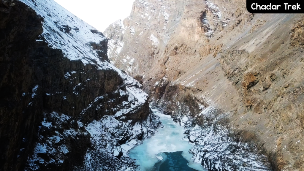
Chadar Trek, Jammu & Kashmir
Region: Ladakh (Leh)
Max Altitude: 11,100 Ft.
Approx Trek: 62 Kms
Grade: Difficult
Chadar (Chaddar), sounds familiar, right? As you know, what a Chaddar is in India. Here chadar refers to, the river turns into a blanket (which means cheddar in Hindi), and you have to pass it, that’s how it is known as the Chadar trek.
It is one of the high-altitude treks and has an altitude of 11,150 ft, so it’s bound to be cold here. So, the temperature here remains -20ºc, which makes it even more thrilling.
The trekking begins from the Chilling village, it further leads to Zaribago, Deepyokma, Nyarak village, Nyarakpulu, Lingshed, Tso Mopoaldar to Tilatdo.
How To Reach Chadar?
Neareast Airport: Kushok Bakula Rimpochee Airport, Leh
Nearest Railway Station: Jammu Tawi Railway Station
Through Road: 563 Km from Delhi.
Stok Kangri Trek, Jammu & Kashmir

Region: Ladakh (Leh)
Max Altitude: 20,100 Ft.
Approx Trek: 40 Kms
Grade: Difficult
Stok Kangri is one of the most challenging treks in Ladakh that not only includes mere high-altitude trekking but also mountain trek, steep trekking through snow, mountain climbing, etc. This trekking will not just only just take you to high altitudes but also promises to test your endurance every time.
This adventurous trip commences from Sumdo, then heads to Shanfa La via Shang Phu, further to Tokpo Rivera, Matho La through Ganagpoche. And then you make your way to a ride which has gives the stunning view of Saltoro Kangri. Thereafter to the Stok Kangri Peak.
Hor To Reach Stok Kangri?
Nearest Air: Kushok Bakula Rimpochee Airport, Leh
Nearest Railway Station: Jammu Tawi Railway Station
Through Road: 588 Km from Delhi.
Kinnaur Kailash Circuit Trek, Himachal Pradesh

Region: Himachal Pradesh
Max Altitude: 17,380 Ft.
Approx Trek: 30 Kms
Grade: Moderate
Kinnaur Kailash Circuit is ideal to opt for a spiritual tour to Himachal Pradesh which is an abode of Lord Shiva. According to the legends, this place was used by Lord Shiva to organize the meeting of all gods and goddesses.
This high-altitude trek usually takes 11 days to complete, it starts from Thangi village near Chail, is navigated through Charang village, Charang La which stands at a height of 17,200 ft. , and ends in Manali via Chitkul, Losar, and Toba. The highlight of this Kinner Kailash Circuit is Kinner Kailash Shivling, which is 79 feet tall and 40 feet wide.
How To Reach Kinnaur Kailash Ciruit?
Nearest Airport: Jubbarhati Airport, Shimla
Nearest Railway Station: Kalka Railway Station, Shimla
Through Road: 614 Km from Delhi.
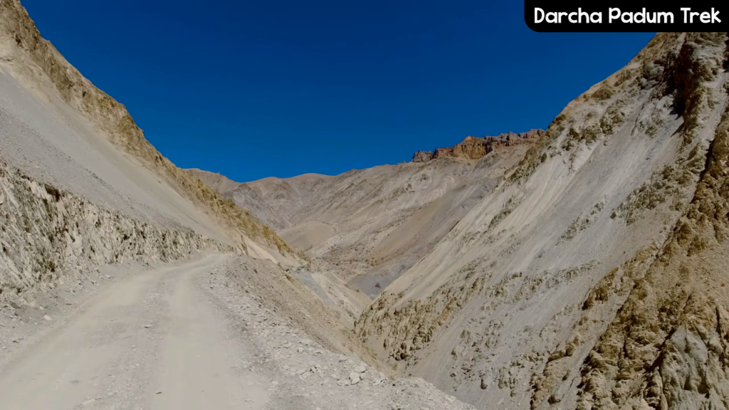
Darcha Padum Trek, Jammu & Kashmir
Region: Leh
Max Altitude: 16,700 Ft.
Approx Trek: 62 Kms
Grade: Moderate
It is one of the popular high-altitude treks in the Leh/ Ladakh region. You will explore the Lahaul area and the three main regions of Ladakh if you choose this place.
Commencing from Darcha in Lahaul valley, the route further leads you to places like Palamo, Zanskar Sumdo, Chuminakpo, Lakong, Purne, and Ichar before reaching Padum.
How To Reach Darcha Padum?
Nearest Airport: Bhuntar Airport, Kullu
Nearest Railway Station: Chandigarh Railway Station
Through Road: 630 Km from Delhi.
Auden’s Col Trek, Uttarakhand

Region: Uttarakhand
Max Altitude: 18,012Ft.
Approx Trek: 75 Kms
Grade: Difficult
This trekking is inarguably one of the toughest treks in India. The highlight of this high-altitude trek is that it forms a bridge between -a west ridge of Gangotri, which stands at an elevation of 6,580 m, and the east ridge of the Jogin at 6,465 which connects the pilgrimage sites of Gangotri and Kedarnath.
The expedition begins from Gangotri, through Nala Camp, and further leads to the Rudugaira Base Camp, Basecamp Gangotri Group, before reaching Auden Col Base. You’ll experience places like Khatling Glacier, Waterfall Camp, Masar Tal, Vasul Tal, Chowki, Kedarnath, Gaurikund, Rudraprayag, and at last Rishikesh.
How To Reach Auden’s Col?
Nearest Airport: Jolly Grant Airport, Dehradun
Nearest Railway Station: Haridwar
Through Road: 296 Km from Delhi.
Also Check Out These Blog Posts:
- Explore The Prehistoric Cave Paintings From Hundred Thousand Years Ago In Faridabad
- Top 10 Weekend Getaways From Delhi
- Top 10 Places To Visit On A Budget In India

- Top 10 Destinations To Visit In Winter In India

- Top 10 High-Altitude Treks In India

- The 12 Jyotirling Temples Of Lord Shiva In India
Kalindi Khal Trek, Uttarakhand

Region: Uttarakhand
Max Altitude: 19,500 Ft.
Approx Trek: 99 Kms
Grade: Difficult
The Kalindi Khal is one of the most challenging high-altitude treks across the highest mountains of the Himalayan Range. This expedition is only meant for the people who are seasoned trekkers with very high physical fitness and knowledge of mountaineering techniques.
This trail is blessed with views of some of the most beautiful peaks like Kamet, Shivling, Mana, Meru, Nikantha, and many more. This trek stays on the top of a professional trekker’s bucket list, which connects the two holy towns of Gangotri and Badrinath.
How To Reach Kalindi Khal?
Nearest Airport: Jolly Grant Airport, Dehradun
Nearest Railway Station: Hardiwar
Through Road: 450 Km from Delhi.
Pin Parvati Pass Trek, Himachal Pradesh

Region: Himachal Pradesh
Max Altitude: 17,382 Ft.
Approx Trek: 110 Kms
Grade: Moderate
Pin Parvati Pass is approximately 110 km long, which would take 16 days to complete. The highest point of this expedition is Pin valley, which is located at a height of 5300 m.
The trip commences from Khirganga to Manali which passes through places like Tunda Bhuj, Odi Thach, Thakur Kuan, Mantalia Lake, and Base of Pin Parvati Pass.
How To Reach Pin Parvati Pass?
Nearest Airport: Bhuntar Airport, Kullu
Nearest Railway Station: Jaginder Nagar Railway Station
Through Road: 350 km from Delhi.
Bhaba Pass Trek, Himachal Pradesh

Region: Himachal Pradesh
Max Altitude: 17,250 Ft.
Approx Trek: 48 Kms
Grade: Challenging
Bhaba Pass is one the most thrilling high-altitude trek on this list. The trip is loaded with stunning attractions like Dewy Meadows, Stark Landscapes, River Valley, and Mudh along with the Himachali culture and Buddhist monasteries.
How To Reach Bhaba Pass?
Nearest Airport: Bhuntar Airport, Kullu
Nearest Railway Station: Jaginder Nagar Railway Station
Through Road: 352 Km from Delhi.
Kedarkantha Trek, Uttarakhand
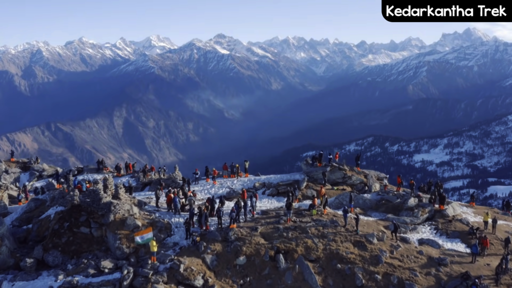
Region: Uttarakhand
Max Altitude: 12,500 Ft.
Approx Trek: 23 Kms
Grade: Easy
Kedarkantha is the perfect one for snow lovers. This high-altitude trek is enjoyed by both beginners and experienced trekkers and is recommended to visit during the winter season.
The trekking is rich of snow covered campsites, pine forests and summits with panoramic views of the surronding ranges.
How to Reach Kedarkantha?
Nearest Airport: Jolly Grant Airport, Dehradun
Nearest Railway Station: Dehradun Railway Station
Through Road: 450 Km from Delhi.
Kedartal Trek, Uttarakhand

Region: Uttarakhand
Max Altitude: 15,748 Ft.
Approx Trek: 38 Kms
Grade: Medium
The Kedartal, which is one of the high-altitude treks is considered as the gem of Uttarakhand, surrounded by spectacular peaks like Mt Thalay Sagar, Meru, Mt Bhrigupanth.
The expedition begins from Gangotri, the route involves a steep rocky climb along the narrow Kedar Ganga. Which further leads to Kedarkharak to Kedartal.
How To Reach Kedartal?
Nearest Airport: Jolly Grant Airport, Dehradun
Nearest Railway Station: Dehradun Railway Station
Through Road: 303 Km from Delhi.

